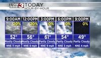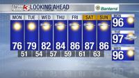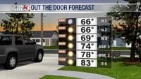


Carterville Ill. (WSIL) -- Another hot day in store for the area with upper 90s expected for highs. We saw some early morning storms across southern Illinois and I do expect more isolated activity across the same areas later this afternoon. Not everyone will get wet but something to look out for that may help in shunting the heat a bit.
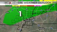
Our cold front arrives on Friday and lingers across the area on Saturday providing not only some relief from the heat but also showers and storms across the area. Not expecting much in the way of severe weather but we could see some storms with some heavy downpours. We certainly need the rainfall so we will take it!

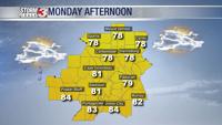
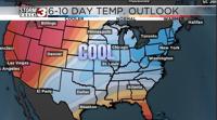
After the front passes on Saturday our temperatures return to normal and even below normal with some lower 80s for highs. There is even potential for cooler weather depending on how strong the second dry cold is on Sunday. A few more days of heat before we get some much needed relief!