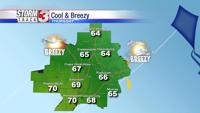


CARTERVILLE (WSIL) -- The sunshine has led to more warm temperatures this afternoon. Temperatures have climbed into the low to upper 80s. Enjoy the calm, scattered showers and storms will move back in this evening.

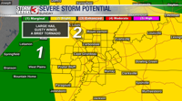
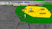
The best chance for storms will be across the eastern half of the region. An isolated strong to severe storm is also possible. The main hazards are hail, lightning and gusty winds. The tornado threat is very small but not zero.
Multiple waves of storms are likely. The first is expected as early as 6PM, with another round beginning near midnight and continuing into Thursday morning. By the afternoon storms should be out of the region, followed by another long dry stretch.

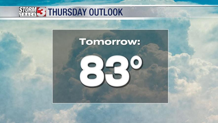
Aside from the rain and storms, it will be warm. Highs Thursday will be above average, topping out in the low to mid 80s.
The extended forecast looks dry and warm, very summer-like.