CARTERVILLE, Ill. (WSIL) -- Be sure you have your umbrella as rain and thunderstorm chances are going to stick around for a little longer.
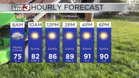
This morning, we are waking up to another round of rain with the potential for some severe thunderstorms. We have a level 1 Marginal risk for severe weather for all of southeast Missouri all of southern Illinois and a portion of western Kentucky. Temperatures are starting out in the mid 60s and will climb to the mid 70s in the afternoon hours.
Tonight, we will see cloudy conditions remain with a small chance of some precipitation. Temps will be mild and winds will be around 10 mph at times.
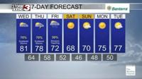
For Thursday, again we have a level 1 Marginal risk for severe weather. We have a potential for scattered thunderstorms throughout the entire day. Temperatures again will start out in the 60s and top out in the mid 70s. Winds will be around 15 mph in the afternoon hours.
After Thursday, we should dry out with the potential for a nice weekend.