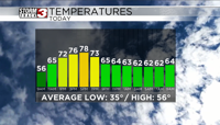


WSIL(Carterville, IL)-- This morning we are tracking a few isolated showers and temperatures that are in the low to mid 50s.��
As we go throughout the day, the isolated showers this morning will likely be moving out of the area, and this will lead to some sunshine this morning. We will see temperatures warm into the mid to upper 60s to near 70 by lunch time, and afternoon highs today will be in the mid to upper 70s. Skies this morning should be mostly sunny, before more cloud cover moves in this afternoon, and skies become partly cloudy.��
Isolated showers and thunderstorms are possible in our northernmost counties, but no severe weather is expected this evening.��
We could see morning lows tomorrow in the upper 50s and lower 60s across the region tomorrow morning, and highs tomorrow will be in the low to mid 70s across southern Illinois and in the mid to upper 70s across southeastern Missouri.��
Tomorrow, we are tracking the potential for active weather.��
We could see a few isolated showers tomorrow morning, before we see some dry time in the afternoon.��
We will see a line of showers and storms develop tomorrow afternoon, and track west to east. This line could produce damaging winds, hail, and a brief tornado can't be ruled out.�� There is some disagreement in terms of placement, and timing but generally, areas towards the west have a better chance of seeing a few strong to severe storms.��

There is already a level 2 risk for southeastern Missouri and southern Illinois,��level 1 risk further off towards the east.��
Independent of any severe thunderstorms, we could see wind gusts out of the southwest at 20-25 miles per hour today, and up to 40 miles per hour tomorrow.����