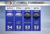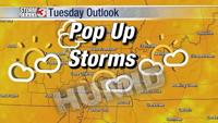


Carterville Ill. (WSIL) -- The clouds have continued rolling in as more disturbances edge their way closer to the viewing area. Expecting a more cloudy day today than previous days with the occasional isolated shower here and there. We haven't quite moistened up the atmosphere fully so expecting a lot of the activity moving in to dry up.
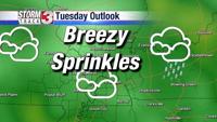
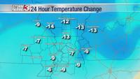
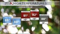
Similar situation tomorrow where systems will try and head in our direction but dissipate as they do which will lead to mostly just clouds and few isolated showers. While southerly flow returns warming up our temperatures and increasing humidity, the clouds will still help to keep us below normal by a few degrees for today and Tuesday.

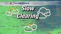
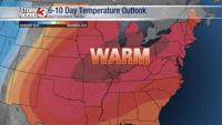
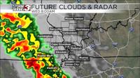
On Wednesday we see our atmosphere recover a bit to allow at least some storm activity to reach SEMO. Expect a more rainy day around that part of the viewing area while the rest of us just see isolated storm chances and of course cloud cover. By Thursday and Friday we all are finally fairly warm and humid with temperatures returning to the 90s and scattered storm chances area wide.