
WSIL (Carterville, IL)-- This morning, we are tracking very similar conditions to what we saw yesterday. Temperatures are once again very warm for all of us this, and we are seeing widespread rainfall across our region. Once again, we are not tracking any wintry precipitation this morning.
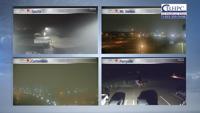
This morning we are tracking a dense fog advisory that includes most of our counties. This is for reduced visibility that could be at or below a quarter mile through 12PM this afternoon. Use caution while driving.
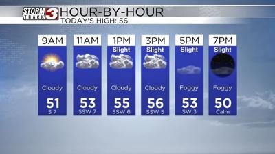
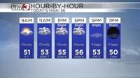
Today, you can expect to see wide spread rain through the morning commute. Shower chances will decrease drastically through the morning hours, and by 9:00, we should see most of the shower activity focused on western Kentucky. We will retain isolated shower chances that through mid afternoon, but it certainly won't be a washout.
Temperatures will be in the low to mid 50s through the early morning hours, and will increase through out the day. Highs should be in the mid to upper 50s, to near 60 today with the warmest locations being further towards the south.
This evening, we will see lots of dry time, and we are tracking dry conditions through the overnight hours and through the morning commute tomorrow. We also could see dense fog return to the region overnight tonight.
Tomorrow, we are tracking temperatures that will start in the 40s. We will see rain chances go up through mid morning and last through the early afternoon. Highs should be in the low to mid 50s.
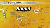
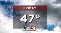
For the end of the work week, we are tracking highs near 50 for Friday with dry conditions, before showers return to the area Saturday.