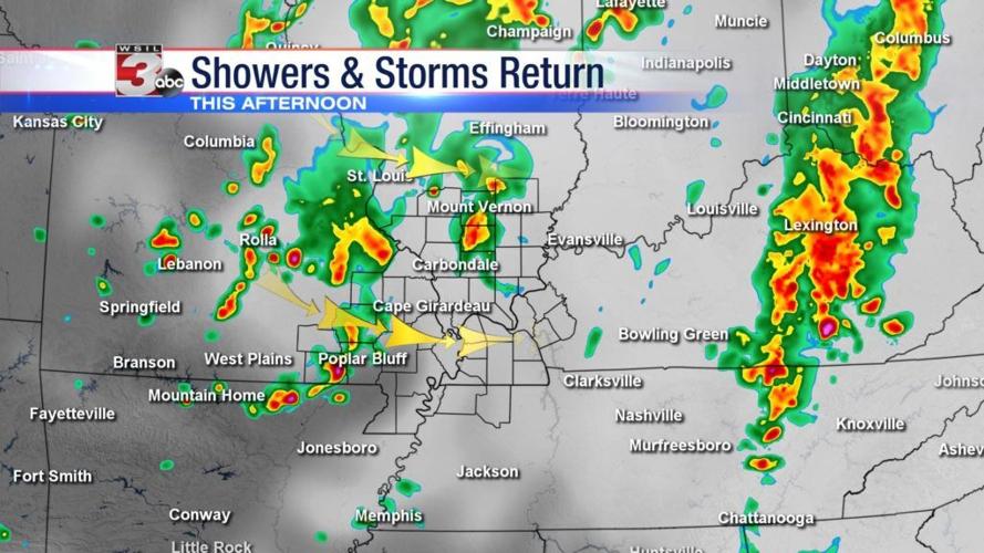


CARTERVILLE (WSIL) �� The string of consecutive dry days will end at two for many as showers and thunderstorms return Wednesday afternoon.
A fast moving storm system will track into the Midwest Wednesday and drag a cold front into the region by the evening. Showers and a few thunderstorms will become more numerous later in the afternoon with the best chances of rain in southern Illinois expected to be west of I-57.
An isolated strong storm with hail and gusty winds can’t entirely be ruled out, mainly in southeast Missouri where there’s a bit more instability to tap in to.
Rain is in and out quick this evening as we return to cool, dry, and low humidity weather by Thursday morning.
Chief meteorologist Jim Rasor has the latest forecast tonight on News 3.