


We are gearing up for a warm and increasingly humid week, with temperatures generally ranging from seasonable to slightly above average. Hazy skies, a lingering effect of Canadian wildfire smoke, are expected to continue through the weekend and potentially into early next week, impacting air quality.
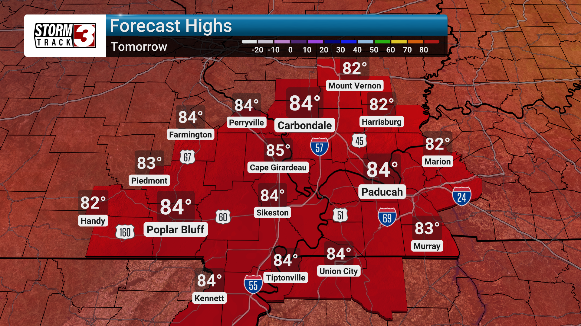
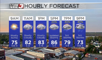
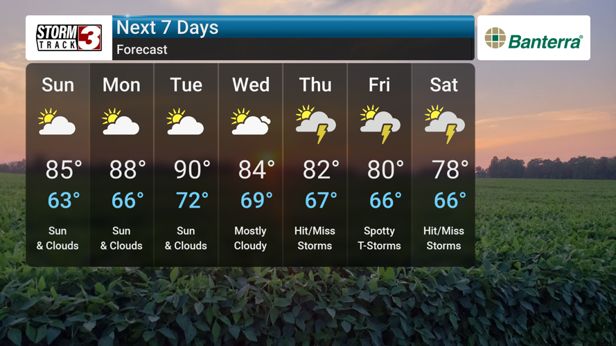
For the immediate future, Saturday will bring a mix of sun and clouds, with highs in the low 80s and overnight lows in the low 60s. Sunday will feature more sunshine, and temperatures will climb into the mid 80s for highs, while lows remain in the low 60s. There's a slight chance of thunderstorms Sunday afternoon, particularly in southern parts of southeast Missouri, western Kentucky, and the far southern tip of Illinois. Any storms that develop could produce small hail and gusty winds. The warming trend continues into early next week. Monday will be mainly sunny with highs in the upper 80s and lows in the mid 60s. Tuesday will see partly cloudy skies and even warmer conditions, with highs reaching the low 90s and lows in the low 70s. After a drier period on Monday and Tuesday, residents should keep an eye on the forecast for midweek, as daily chances of thunderstorms return from Wednesday through next weekend, with the potential for some storms to become severe. Wednesday will be mostly cloudy with highs in the mid 80s and lows in the upper 60s. Thursday is expected to bring thunderstorms, with highs in the upper 70s and lows in the mid 60s.