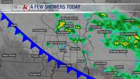
CARTERVILLE, Ill. (WSIL) -- A small chance for rain continues across the region this evening with more thunderstorms expected to arrive on Sunday.
Temperatures remain steady in the mid-60s with light winds from the northeast. A few showers are possible this evening and overnight.
During the overnight hours, rain and thunderstorm chances continue and should taper off by the morning hours. Temps will stay mild, hitting only a low in the lower 60s.
On Sunday, the area faces another threat of severe storms. We will start out with some chances for rain and clouds will remain overcast. If you are planning to attend any Easter services in the morning, you may want to bring an umbrella just in case. Temperatures will start out in the 60s and climb into the upper 70s by the afternoon.
By Sunday evening, storms are expected to arrive and look to be severe at times.
A level 2 Slight risk for severe weather is in place for most of southeast Missouri, excluding Mississippi, New Madrid, Scott and Pemiscot Counties. The level 2 risk also applies to Randolph County and the western portion of Jackson County.
A level 1 Marginal risk affects the rest of the region, except for Gallatin, White and Hardin Counties in Illinois and Calloway, Crittenden, Caldwell, Graves, Marshall, the eastern portion of McCracken and Lyon counties in Kentucky.
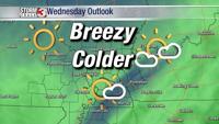
On Monday, rain and thunderstorms are expected to taper off in the early morning. Temperatures will climb into the upper 60s with some areas hitting the 70 mark. Clouds will also move out some making for partly cloudy conditions.