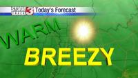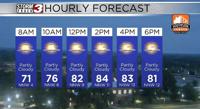


CARTERVILLE (WSIL) -- All good things must come to an end�� Our break from heat and humidity is over as temperatures will push into the lower 90s Wednesday afternoon.
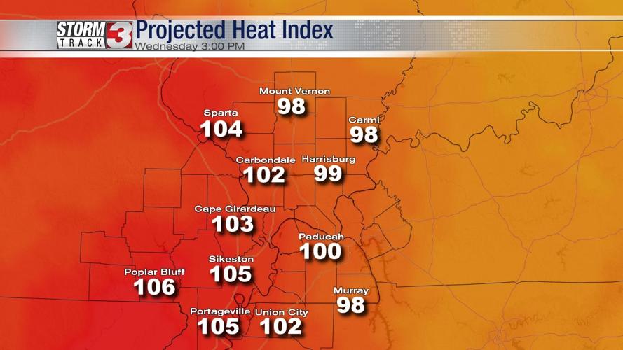
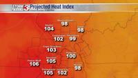
In addition to warmer afternoon temperatures, more notable, the humidity will push the heat index from 100 to 105º. The highest heat index is expected west of the Mississippi River in Southeast Missouri.

For the most part, the daylight hours will be dry Wednesday in our region. There's a small chance for a few showers between 7 a.m. and 11 a.m., mainly in Southeast Missouri.

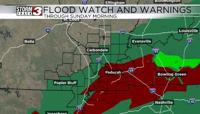
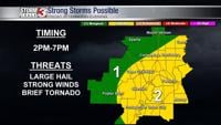
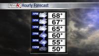
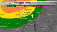
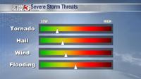
A complex of storms is expected to develop later this afternoon west of the St. Louis Metro area. This complex of storms will track east, likely arriving along the I-64 corridor later in the afternoon or even into the early evening. A few storms could be strong with hail, damaging winds, and very heavy rain. The tornado threat is lower, but a brief spin-up can't entirely be ruled out.

Later into the evening, the risk for severe storms will decrease, but flash flooding could become a signficant issue, especially in Southern Illinois.
Meteorologist Nick Hausen has the latest on News 3 This Morning. We've got you covered!