(WSIL) -- Another round of showers transitioning over to snow may create minor travel impacts early tomorrow.
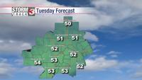
Saturday starts cloudy and cool, but another quick passing system will bring chances for scattered light showers this afternoon. High's this afternoon likely remain in the high 30s, before dipping into freezing territory overnight.
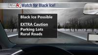
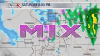
As temperatures drop, snow will likely mix in overnight, primarily for folks north of a line from Poplar Bluff, MO to McLeansboro, IL. With ground temperatures still above freezing for most, accumulations may mostly be confined to grass, or other elevated surfaces. Overall, minor accumulations are expected, but some areas like Franklin, Jefferson, and Hamilton counties could see slick spots early Sunday morning, as ground temperatures look a bit colder in that direction.
I'll be timing it all out on News 3 this morning.