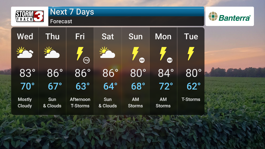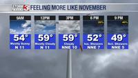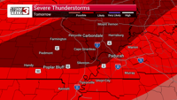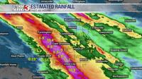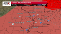

Significantly more summer-like conditions are expected to arrive today, which will be hotter and more humid with a small chance of showers. Severe thunderstorms are possible Thursday and Friday, with a risk of hail and tornadoes, so stay tuned for forecast updates. Showers and storms may continue sporadically from Saturday through Tuesday.
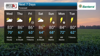
Wednesday will see temperatures ranging from a high of 82°F to a low of 69°F. Mix of sun and clouds. Highs in the low 80s and lows in the upper 60s.
Thursday will see temperatures ranging from a high of 84°F to a low of 66°F. Mostly cloudy. Highs in the mid 80s and lows in the mid 60s.
Friday will see temperatures ranging from a high of 86°F to a low of 61°F. Afternoon thunderstorms. Potential for severe thunderstorms. Highs in the mid 80s and lows in the low 60s.
Saturday will see temperatures ranging from a high of 81°F to a low of 58°F. Times of sun and clouds. Highs in the low 80s and lows in the upper 50s.
Sunday will see temperatures ranging from a high of 78°F to a low of 61°F. Considerable cloudiness. Highs in the upper 70s and lows in the low 60s.
Monday will see temperatures ranging from a high of 72°F to a low of 64°F. A few morning showers. Highs in the low 70s and lows in the mid 60s.